



Lands of Extraordinary Biodiversity
The soaring mountains, dense rainforests, staggeringly long coastlines, thousands of islands, and rich coastal plains have resulted in Latin America boasting a diversity of plant and animal species unique among the world’s regions. Extensive rainforests and jungles in parts of the region have created many isolated natural habitats. With an estimated 30-40% of the world’s species, and three of the top five countries (Brazil, Colombia, and Mexico) with the most bird, amphibian, mammal, reptile, fish, and plant life, Latin America has a wealth of biodiversity.
The Latin American region has become a leader in biodiversity conservation with 20% of its land set aside for conservation, far surpassing what has been achieved in other developing regions of the world. Among all the countries, Costa Rica has been a global leader in conservation. Once plagued by a high rate of deforestation, the country has designated 25% of its land as protective parks and reserves. In early 2019, the country’s President announced the launch of an ambitious project to achieve zero net carbon emissions by the year 2050. In regions like the Brazilian Amazon, however, deforestation for farming and illegal mining are a serious threat to the environment.
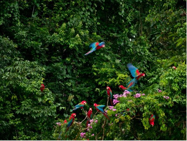
The Amazon jungle is an extraordinary ecosystem that contains a large portion of the world’s forest cover and immense biodiversity. Environmental destruction is nevertheless a continuing significant threat to this incredible area. Macaws in the Amazon Photo by Vi Gregnol
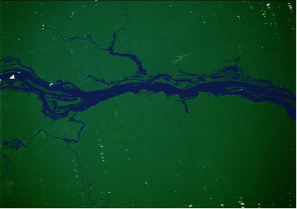
Immense areas of unbroken rainforest are seen in this photo taken from space (207 miles above the earth) in 1986 of this 46-square-mile view of the Rio Negro. The Negro is a major tributary that joins the Amazon River where the city of Manaus was established. Soils in this part of the river basin are sandy and not suitable for agriculture so the forest here will likely remain relatively intact. Photo from Jay Apt, Michael Helfert, and Justin Wilkinson, Orbit: NASA Astronauts Photograph the Earth. National Geographic Society: Washington (1996). NASA Photo Number STS61C-33-78.
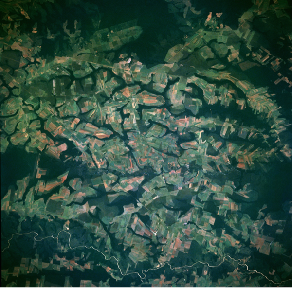
Taken from space 185 miles above the earth in 1993, this image shows 41 square miles of the western part of the state of Mato Grosso, Brazil. Farms have been established in newly cleared parts of the Amazonian rainforest. The Rio Sangue at the bottom of the photo floods the surrounding forest during the rainy season to depths of 10 to 40 feet, so these areas are only occupied during the dry season. Photo from Jay Apt, Michael Helfert, and Justin Wilkinson, Orbit: NASA Astronauts Photograph the Earth. National Geographic Society: Washington (1996). NASA photo number STS056-97-80.
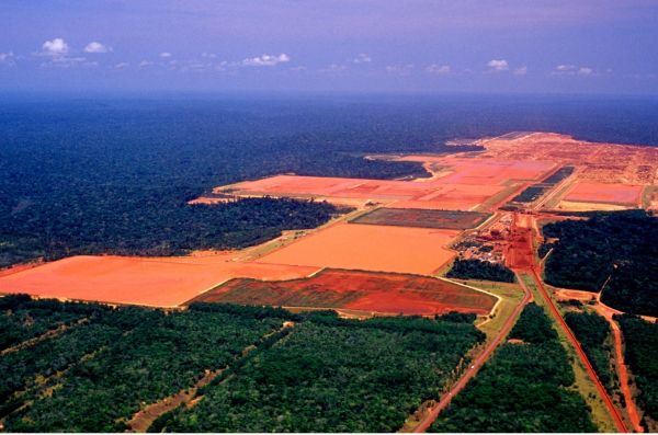
Damage caused by the extraction of bauxite in the middle of the Amazon. Photo by luoman.
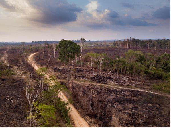
Drone view of an illegal dirt road to open land for ranching in the Jamanxim National Forest, Para, Brazil. Photo by Paralaxis.
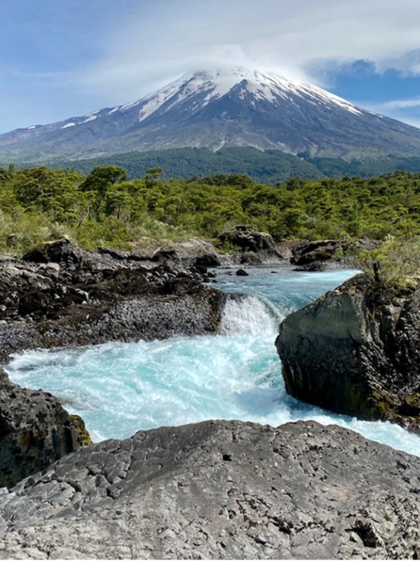
Vicente Pérez Rosales National Park near Puerto Varas, Chile is one of several preserves that provides protection of scenic snow-covered mountains, glaciers, lakes, and rivers. Photo by Bill DeWalt, 2020.
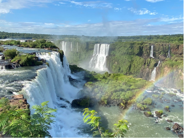
On the border between Argentina and Brazil, the two UNESCO World Heritage Sites, Iguazú (Spanish spelling) National Park and Iguaçu (Portuguese spelling) National Park, contain a series of waterfalls that extend over 1.7 miles (2.7 km). Islands and rocks in the river create approximately 275 separate waterfalls varying between 200 and 269 feet (60 and 82 meters) in height. Photo by Bill DeWalt 2020.